Showing posts with label Journal Entry. Show all posts

Friday, July 19, 2019

Journal Entry: Thursday, 7/4/2019

Day 7 of 10

Stats

14.8 miles
3,696' elevation gain
7.0 hours hiking

Photos

Link to all photos and videos from day 7.

Journal Entry

italics = original journal text
regular = added during transcription

I made it to Timberline Lodge! It's a long and sandy slog made 100% worth it by seeing Kylie and then starting back off with Geoff and Ivan. I gorged myself at the lunch buffet, reloaded my pack with fresh food, fuel, and water and then the three of us set off. 

There are a lot of people out and about, a sure symptom of the July 4th holiday.

After our luncheon rendezvous, Ivan, Geoff, and I set off fom the ski slopes of Timberline Lodge around 2:00pm. During my 3 miles in and 3 miles out of here, I saw as many hikers as I did in the past 6 days/125 miles. A fun(ny) mix of long-distance hikers, backpackers, day hikers, and strollers (not the baby stroller kind; like one who is out for a short stroll from the car).

Our goal for the evening was Paradise Park, a grassy alpine meadow high on a more accessible slope of Wy'east. Because of its idyllic locale and open view toward the Willamette Valley, I knew the fireworks views of July 4th would make it a popular destination for others. Among the 5 or 6 other groups, we found a spot near the trail with room for 2 flat-ish-ish pitches.

Ivan made his first of 3 home run hiking dinners: Frito Pie (dehydrated beans, rice, taco seasoning, Fritos). My hiker hunger was increasing, so even after the heavy dose of lunch buffet I was ecstatic for a new dinner. Once the sun finally went down we saw 30+ tiny fireworks shows from the valley below.


An awesome 3D carved topographic sign.

Enjoying the weather and excited for company.

Hello, Wy'east :) Waiting for my lunch crew to arrive.

Last 50 miles, here we go! ZigZag Canyon in the background.

Paradise approaching.

Camp, night 7.

Oh yumm.

Wow.

Journal Entry: Wednesday, 7/3/2019

Day 6 of 10

Stats

23.3 miles
3,069' elevation gain
10.0 hours hiking

Photos

Link to all photos and videos from day 6.

Journal Entry

italics = original journal text
regular = added during transcription

A long day in the green tunnel.

Today was all about timing for tomorrow. Tomorrow was when Kylie was meeting me at Timberline Lodge with Geoffrey and Ivan and Timberline Lodge was where a lunch buffet was. They were scheduled to arrive around noon while the buffet opened at 11:00. After 110 miles over 6 full days of hiking, my appetite was healthy.

Needless to say, I wanted to plan for an 11:00 buffet arrival, meaning I would try and hike enough today to leave no more than 10 miles tomorrow morning. 

Again, the weather was great for hiking: overcast and 55°F. My rain jacket was enough to break the nip without causing me to sweat until hiking uphill, of which there were a few today. And now I'm officially on the slopes of Wy'east. 

I got an early start this morning, around 6:45 and after only one other hiker. Within the first 3 hours I saw 5 new southbound PCT hikers. Then I got to the popular weekend destination of Timothy Lake. 

It actually wasn't crowded, even for being the day before a long weekend. I passed a few occupied camps including one boat-up site which looked like fun. I was also startled by a "hello" which came from none less than a mountain biker. It was then that I realized how much our mind relies on hunches to construct a general idea of our surroundings. Over the past 6 days of hiking, my mind had become dependent on trusting that if I look back (which I often do when hiking alone) and see no one for 100 yards, there will be no one behind me for the near future - it takes a long time to make up 100+ yards at a hiking pace.

I was hit with this realization like, immediately, because there was a fucking cyclist on the PCT! I stopped hiking, faced him, and stood in the middle of the trail until he was just a few feet from me and had to unclip his pedals and stop. "Bikes aren't allowed on the PCT ya know," I said.

"Yeah sorry, I'm just visiting from Phoenix and I got a little lost," was his excuse.

"Well what trail did you turn onto this one from? I can help you find it on my app."

"I'm not sure, I was just riding around the lake," he states and then walks his bike off the trail and around me, realizing that I'm not moving for him. 

"Bikes aren't allowed on this trail so if you're not going to find the right one then you should probably walk your bike."  (this is actually the official, signed rule for the 600' section of bike trail that overlaps with the PCT just 2 miles north of where we met)

"I've already been riding it this far…" and then his annoyed voice trailed off as he rode away.

Whatever. I made it 23 miles today so now I'm within 10 of Timberline Lodge. Meeting up with Kylie, Geoffrey, and Ivan to eat at the lunch buffet and then hike to Cascade locks with the latter two. 


Leaving the Warm Springs Reservation and entering Wy'east National Forest.

 Little Crater Lake - much smaller but such wow.

 We must be in the PNW.

After a day of hiking in forests and fog, this was an amazing view.

Camp, night 6.

Journal Entry: Tuesday, 7/2/2019

Day 5 of 10

Stats

16.0 miles
1,670' elevation gain
6.0 hours hiking

Photos

Link to all photos and videos from day 5.

Journal Entry

italics = original journal text
regular = added during transcription

Maroon Bells leap of faith (reminder to watch this YouTube video). [insane climbing footage]

Back on trail after a wonderful zero day. After getting into camp around 9:15[pm on Sunday], Kylie and I caught up as I wound down from the high of my day. We spent the next day mostly in our tent taking refuge from the constant mosquitoes and sporadic rain - a surprisingly enjoyable time. 

This morning, we set out for Ollalie Meadow Trailhead, the start of my next segment. Another goodbye and I was off. The trail is definitely more populated now that we are north of the last snow-affected section in Oregon (Mt. Jefferson) - I saw a total of 11 hikers, all of which are either thru hiking (via jumping around to snow free areas) or doing sections of Oregon like me. Eight of us are camped in the vicinity of Warm Springs River.


Trying my best to organize my resupply, unpack, swap packs, and re-pack all in the back of Kylie's Crosstrek. The mosquitoes were too bad to be outside.


Hiking with Baba (Czech for Grandma) and Payday, thru hikers I leapfrogged with for the next 6 days to Cascade Locks.


Debuting my DIY pack! Spoiler alert: It lasted the remaining 100 miles just fine :)


More trees please.

Sunday, July 14, 2019

Journal Entry: Sunday, 6/30/2019

Day 4 of 11

Stats

26.2 miles
3,112' elevation gain
11.5 hours hiking

Photos

Link to all photos and videos from day 4.

Journal Entry

italics = original journal text
regular = added during transcription

What an exciting and event-filled day yet again! Once again, Lauren, Jerry, and I departed for another segment of snow travel - 10 miles today. Having traversed 8 miles thru unknown territory yesterday, I felt confident we would succeed.

We learned that snow is much better to walk on in the morning (less slushy, more solid). We learned that Obsidian Spring has the most amazing rocks and, more importantly, the most amazing water. We learned that politics in Australia is not that different than it is here. And we learned that we were all grateful for having each others’ company the previous 24 hours.

After 22 miles together, I felt (somewhat) embarrassingly bonded to them. But having completed their loop around Three Sisters (an impressive feat considering the conditions), they parted way and I decided I would try to push all the way to Big Lake and arrive at camp tonight instead of tomorrow morning. Borrowing half a liter of water before they left, I made and scarfed 2 packs of ramen for dinner and set off.

Doing the math: I had only done 12.5 miles yet it was already 4:00pm - being on the west side of the Cascade Crest, I figured I had until 9:00pm until sundown - that left 14.5 miles in 5 hours. It was faster than I normally hike but I knew it was feasible if I took very (very) few breaks - just keep moving. If I wasn't going to make it, there were two potential places to camp - one 4.0 miles and the other 2.0 miles from Big Lake.

What I hadn't planned on: 4 miles of lava fields and two 800' climbs. I took them in stride, letting my excitement at having surpassed the crux of the hike (Three Sisters snow adventure) take over. I danced (aka fist pumps on repeat) and sang my way down the trail to Boston (thanks for the recent reminder, Dad). Aside from 5 day-hikers in the few miles near Highway 242, I saw no one for 3 hours and 9 miles - I felt as if I had Mt. Washington Wilderness all to myself! 

To see if I could keep pace thru the lava fields and climbs, I checked my watch hourly. I allowed myself a smidge of leeway for being slow on the first half - the second was all downhill and all on dirt trail. As expected, I was a little behind the 3.0 MPH goal after the first 2 hours. Feeling beat down from the lava trail and first climb, I set my timer for 5 minutes and stopped to stretch. My ankles were quite unhappy with the marble-to-softball-sized rocks of which the trail tread was composed but otherwise I felt fine. My ramen bomb was wearing off already, so as I continued walking I refueled with a Milky Way and Clif Block gummies (the ones with caffeine!). 

The following 10 miles were delightfully uneventful - that is to say expectedly moderately challenging with some nice views of Mt. Washington. Indeed, I successfully made it to camp at 9:15pm right as the sun finished its beautiful set, surprising Kylie and Sheriff both.

Snow for 1/2 mile sections at a time.


OMG snuh.

A steep traverse where I was happy to have micro-spikes and an ice axe.

Resting in the sun. Photo credit: Lauren.

R to L: Seekseekqua (10,497'), Three Fingered Jack (7,844'), Mt. Washington (7,677', my destination for the night).

Mt. Washington getting closer.

Beargrass!

I made it! One day early makes 92 miles in 4 days.

Journal Entry: Saturday, 6/29/2019

Day 3 of 11

Stats

22.8 miles
3,447' elevation gain
9.00 hours hiking

Photos

Link to all photos and videos from day 3.

Journal Entry

italics = original journal text
regular = added during transcription

What a day! After an uneventful first 10 miles, lots of events happened.


  1. I got service at my second break and called Kylie. 
  2. I got caught in a thunderstorm. Luckily it only lasted an hour or so  I took refuge under a small grove of trees. I hadn't seen any lightning to accompany the loud thunderclaps overhead, but didn't want the first strike to be on my umbrella. So I donned my rainjacket and made some ramen while waiting it out. 
  3. I hiked across Wickiup Plain - such a weird and amazing place. Having just hiked out of the previously mentioned thunderstorm, it felt otherworldly to be hiking across a barren, sunny tundra at the foot of South Sister and siblings. 
  4. I met and hiked with Lauren and Jerry who are finishing their Three Sisters circumambulation tomorrow. We linked up right before the snow began in earnest and it was just the mental safety net I needed to push into the evening. The weather and snow conditions were an unknown, while usually-reliable campsites may be under snow. Regardless, the three of us set off at 2:30 with the goal of pushing halfway thru the 18-mile affected area.
  5. We hiked over 8 miles of snow! And we have 10 more miles tomorrow. Luckily, Geoff and I hiked the latter 8 of them last weekend, giving me valuable insight into the conditions.


Camp, morning 3.

Early morning meadow.

Approaching South Sister (left). Broken Top and Mt. Bachelor (right) also passing by.


Waiting out an afternoon thunderstorm. Listen for the thunderclap at the end!

Wickiup Plain - what a cool place to see.


We met a 4-dog sled team out for a Summer trip!


A few miles into the snow.

Camp, night 3.

Wednesday, July 10, 2019

Journal Entry: Friday, 6/28/2019

Day 2 of 11

Stats

22.0 miles
2,013' elevation gain
8.50 hours hiking

Photos

Link to all photos and videos from day 2.

Journal Entry

italics = original journal text
regular = added during transcription

Lots of mosquitos today! Not as bad as 2016 yet though. Backpacker Radio had a listener question about pooping before vs. after digging the cat hole which I was just thinking about this morning while digging mine! (before pooping, FYI).

Also listened to a This American Life episode about a wimp in a football player body. Reminded me of Daro. "Gary Gullman is getting huge!"

Jeff and I leapfrogged with a couple doing the OR section today. They walked quite fast but took long breaks, so we saw them 4 or 5 times. After hiking together off and on for about 20 miles since yesterday afternoon, Jeff and I split up at one of our breaks today. Here, the mosquitoes were swarming him while leaving me in relative peace so he hiked on without me. He and the couple stayed ahead of me for the rest of the day until this evening when I came upon the 3 of them camped at Mac Lake. It was only 4:00 so I filled a bottle and then ate dinner in my tarp. (yes, I set it up just for dinner - the bugs!!!) I continued on for 5 miles until 6:30 so unless I get a late start and Jeff an early one, we likely won't cross paths again.

In addition to the OR section couple, I met Crash and Princess Polly who are thru hiking this summer. 


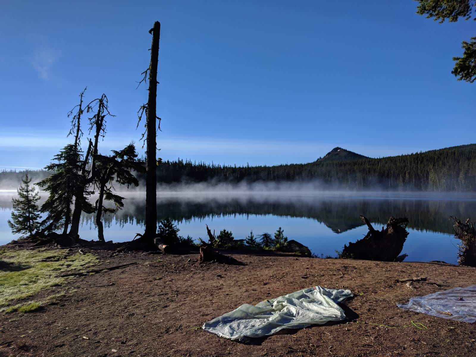
Camp, morning 2.

A sample of the trash picked up at camp.

Hiking with Jeff.


Update from the afternoon of day 1.

Journal Entry: Thursday, 6/27/2019

Day 1 of 11

Stats

20.3 miles
3,370' elevation gain
7.25 hours hiking

Photos

Link to all photos and videos from day 1.

Journal Entry

italics = original journal text
regular = added during transcription

Saying goodbye was easier this time, but not easy. The weather held up most of the day despite us getting rained on all night at Shelter Cove. My flimsy umbrella held up to 4 or 5 deployments today. The rain was light, but it's already been worth having it. 

The day went by quite fast considering the mileage. I started hiking at 8:00 and was eating dinner in camp by 4:30. After leapfrogging throughout the day, another hiker and I arrived at  and set up camp together. [J]eff is a high school math teacher from Eugene who is hiking from Willamette Pass to Hwy 20 (almost the same route as my first of 3 stints). He is planning on 7 days compared to my 5, but I have a feeling we'll be seeing each other.

A heavy rain started in earnest around 6:00, right as [J]eff was retiring to his tent for bed. I quickly gathered my things and followed suit. Another 20 miles are on the docket tomorrow -- I have to make up time to allow for a slower day or two thru There Sisters so I may try for more if I'm feeling well.


 Happy to be back on the PCT.


I LOL'd.


An unexpectedly cool trash pickup.


Camp, night 1.

Thursday, August 18, 2016

Journal Entry: Wednesday, 8/3/2016

Day 15 of 15

Stats

3.6 miles (plus 6.5 other miles to Forest Road 4230)
2,089' elevation gain
4.5 hours hiking
2.24 hiking mph

Photos

Link to all photos from day 15.

Journal Entry

italics = original journal text
regular = added during transcription

There is no journal entry from this day.

After waking up at the semi-established campsite, I noticed that one hiker was already gone while the other duo was packing. I made my hot chocolate, then packed up.

Feeling hopeful that my ankle would be better, I walked the first 100 yards to the nearby creek, where I filtered 2 liters and continued on. While filtering, the older duo that was camped near me passed by, hiking slowly.

Hiking on, I knew within a mile that I needed to quit. My ankle was worse than the previous 2 days and was nearly too painful to walk on, even with my hiking pole for a crutch.  

I scanned my maps, looking for two things: a high point where I could get cell service and an exit point for the trail, preferably leading to a nearby forest road. Luckily, I found both of these at about mile 4 for the day.

After about an hour, I caught one of the hikers that passed me while I was filtering earlier. Her slow pace was a good match for my bad ankle, so we hiked the remaining mile together. She was talkative, which helped take my mind off the pain. Once at the trail junction leading to Forest Road 4220, I said goodbye and let her know my trail name and that I was exiting the trail. 

First, I hiked down this new trail about 1/4 mile to survey its condition. It appeared to merge with an old forest road that matched my maps. I then retraced my steps back to the junction at the PCT.

Now back at a known location, I took a bearing from my maps and, compass in hand, started off-trail up the nearby South Pinhead Butte (5,348'). After a 30-minute excursion through the overgrowth, I stood atop the butte on the trunk of a fallen tree anxiously checking my phones for cell service. Fortunately, I had service on my burner phone and proceeded to call Kylie. I let her know I needed to be picked up and that I would coordinate a pickup with Geoffrey, who has a Jeep that is far more capable on unknown forest roads than Luna.

After a frustrating 30 minutes of losing and gaining cell service, I had coordinated a pickup location with Geoffrey, who gratefully agreed to leave work early to come rescue me. Because I was leaving the trail and going off-itinerary, I gave my current location and proposed meeting location to Kylie in case of emergency.

As I hiked back down the slope towards the trail, I kept my compass out to be sure I was following the correct bearing. After breathing a sigh of relief when I rejoined the PCT, I hiked the short distance back to the trail intersection leading to Forest Road 4220 and began the 5 mile hike out.

The first 3 miles were on an old, unmaintained forest road with a plethora of downed trees. Unlike blowdowns on the well-traveled PCT, these had no existing paths around or over. In addition, the brush lining the road was quite overgrown, meaning my only option was to blaze the trail over each downed tree, fighting through sharp branches. The combination of these obstacles and my injured ankle made for a frustrating and arduous time, but I knew what I had to do.

Eventually, I made it to Forest Road 4220, a dirt road in better shape and continued on towards Forest Road 4230, my pickup point. While hiking these last 3 miles, my mind wandered from reminiscing about my slowly ending hike to wishing for a random car willing to give me a ride. The Advil was wearing off and I was stopping every 5 minutes to rest my ankle, which was getting worse.

Having planned this rescue mission using only Google Maps, I was still uncertain that Geoffrey would be able to reach our pickup point. Some roads that appear fine online can sometimes be unpassable, either by downed trees or locked gates. The worst case would be that he was both unable to reach me and unable to contact to me (neither of us had service). In this case, my only option would be to begin hiking along his proposed route until I met him at his road block. The mere thought of this was sickening, as another X miles seemed impossible at this point. 

2 hours after I left the PCT, I arrived at the intersection with Forest Road 4230. I then realized that I was a couple miles closer on Geoffrey's route than our coordinated pickup point. Instead of suffering through 2 more pointless miles, I sat on the side of the road to wait. I readied my emergency whistle to signal him when he arrived.

After only 10 minutes, I heard the first car of the day and knew it was him. Because he wasn't expecting me for another 2 miles and I was sitting off to the side of the road, he drove right past me as I frantically blew my whistle and waved my arms. I panicked, realizing that if he missed me I would have to hike the remaining miles to our pickup point.

Luckily, he located where the whistle was coming from right as I was going out of view. I breathed a third sigh of relief that day and loaded into his Jeep.

The drive home was pleasant. Our conversation kept my mind off the gravity of the situation; that I was driving away from the trail, away from my goal, and towards the real world at a tremendous speed.

I felt helpless and pathetic in some ways, but empowered in others. I showed myself that I was capable of safely and efficiently coordinating my rescue from the wilderness; that I was capable of making the decision to stop hiking; that I gave it everything I had. Still, leaving the trail at my emotional high-point with only 4 days left was one of the hardest decisions I've had to make.


Forest Road 4220.

Snacking, whistle at the ready. Paved road seen in background.

My rescue team.

Tuesday, August 16, 2016

Journal Entry: Tuesday, 8/2/2016

Day 14 of 15

Stats

20.4 miles (plus 0.5 other miles from Jefferson Park campsite)
2,360' elevation gain
8.0 hours hiking
2.61 hiking mph

Photos

Link to all photos from day 14.

Journal Entry

italics = original journal text
regular = added during transcription

Woke up to the coldest morning yet. Jeff Park was amazing in the morning as expected.

On my way out, I stopped for water at Russell Lake. The low temperature slowed my filter excruciatingly, making my freezing fingers all the more uncomfortable. 

Hiked in my puffy (this was the only time I had to wear my puffy jacket while hiking in the morning) to the top of the pass north of the park (2 miles), then noticed the entire valley and mtn were enveloped in a cold fog. The valley where Jefferson Park is located went from clear and sunny to 100' visibility in 30 minutes (see photo sequence below). The cold wind came howling over the pass, bringing the fog with it. This continued down the other side [of the pass] for about an hour. The north side of the pass was erie [sic] & spooky. Visibility only about 100' and large snow patches. Felt like the moon. R achilles was worse than yesterday, so I wrapped it with an Ace bandage and took some Advil. Helped a lot once it kicked in, but I couldn't tell if the wrap did anything. Hoping it feels better tomrw...

This was the second full day having a sore achilles and I began to worry that it wouldn't get better. I started adjusting my hiking style to ease some of the pain, but this stressed other muscles in my legs. Ignoring the pain was difficult, as I could feel it with every step.

Stopped at Ollalie Lk, whose store was disappointing. Hiking in, I was naively dreaming of burgers and hot dogs, so anything less was heartbreaking. They had a decent beer selection, but limited food. I settled on (Hop Valley's) Alphadelic IPA, Cheetos, & an ice cream bar. They didn't have WiFi or even a cc machine, had to ring me up by hand.

Afterwards, I was both sad and relieved at the lack of technology. I believe that if there would've been cell service or WiFi, I would've called Kylie and discussed getting picked up (due to ankle). This may have indeed been the right call to make, but I was still hopeful that my ankle would get better.

I met a few SoBos out front [of the store]. A friendly bunch who even gave me some heel lifter insoles. He said he struggles w/ the same issue and that they helped.

Walking around out front of the store, I felt that these may help. Once back on trail however, they made little-to-no difference to my already-injured ankle.

Saw my first bear around mile 16 today. It just ran across the trail about 50' in front of me.

After the spectacular scenery the day before and the bear sighting today, I began to feel that my hike was coming to an end; that these were offerings from the trail before I was forced off.

Didn't have service all day after descending the pass at mile 2, despite leaving my burner phone on all day. I hope that changes tmrw. It was nice to txt Kylie for the 30 mins I could.

Camped @ a large-ish spot w/ 2 other groups. Everyone was tent-bound by 6.


 Hiking out of Jefferson park (7:08am).

 Fog just starting to roll in (7:38am).

Fog increasing (7:45am). 

At the top of the pass (8:09am).

 Looking north towards where the trail leads.

Trail descending on snow through fog.

 Lunarscape.

Numerous large cairns; evidence that this area gets high snow levels late into the season. 

More unique trail.

Camp, day 14.

Journal Entry: Monday, 8/1/2016

Monday, 8/1/2016: Day 13 of 15

Stats

19.4 miles (plus 1 other miles to Jefferson Park campsite)
4,152' elevation gain
7.75 hours hiking
2.63 hiking mph

Photos

Link to all photos from day 13.

Journal Entry

italics = original journal text
regular = added during transcription

New month, new day.

Hiked in[to] Jefferson Park today after 19 miles & 4,100' elev gain, R achilles sore all day. This was only somewhat unsettling. I've dealt with a sore achilles tendon before, but most times it would get better throughout the hiking day. This time, it was sore from about mile 3 through the end of the day. Was planning on stopping @ Breitenbush CG (5 miles further), but my sore ankle and the setting thought otherwise. And boy am I glad. This huge meadow lies just north of Mt. Jefferson. A few modest-size lakes are near the PCT. I'm staying about 100 yds east of Russell Lake at a lesser used spot among the patches of trees. The view of Jefferson is amazing. Reminds me Mt. Hood up close.

The ranger I spoke to below essentially told me that I could camp wherever I wanted; he and his partner weren't going to be patrolling that area for permits that night. However, I didn't want to set a bad example by displaying to others I was breaking the rules.

I first found a spot right on the lake, but only reserved designated sites are allowed w/in 250'. I took the opportunity to dry my ground cloth, clothes (after a swim), and quilt while basking in the sun. I then packed up and hiked ~1/2 mile to the far side of the lake & a bit beyond. Favorite campsite so far.

Not only was this campsite aligned with the rules, it was more secluded and had better views of the mountain.

Ran into a ranger rt after Russell Creek (not related to lake) who was out searching for a lost teenaged hiker (actually 21 years old). The helicopters and planes have been incessant throughout the day, searching from the summit to Jefferson Park.

I learned from the ranger that Riley Zickel was the missing hiker. He departed on an overnight trip the previous Wednesday (6 days prior) and had not been seen since.

After crossing the raging Russell Crk, this news was a stark reminder of nature's unyielding force. I hope he's alive & found.

Russell creek was the most treacherous crossing I encountered on my trip. While not comparable in danger to early-season crossings in the Sierra Nevada range, it presented a challenge that was not trivial. I spent 30 minutes walking upstream and back, searching for the safest spot to cross. Eventually, I made the crossing near where the trail intersects the creek.

Started Red Rising (audiobook) today & I think I'll like it. Already on Ch. 13(?). The one where Daryl (Daro?) is at the carver.


 Headed towards Mt. Jefferson (10,497').

More unique trail.

More unique trail, this one through a colorful meadow.

Views opening up, Mt. Jefferson getting closer.

Three Fingered Jack (7,841') 10 miles to the south.

 Looking up towards the summit of Mt. Jefferson from Milk creek along the western slopes.

Final switchback before descending to Russell creek.

Red stick figure is my size and is shown for scale.

 First picture from Jefferson Park.

First campsite, just drying everything out.

 Just like being at the laundromat; except way better and nothing like the laundromat.

Having second dinner, Jefferson Park.
#wildernessculture or something. 

Sunset from camp in Jefferson Park.