Friday, July 19, 2019

Journal Entry: Wednesday, 7/3/2019

Day 6 of 10

Stats

23.3 miles
3,069' elevation gain
10.0 hours hiking

Photos

Link to all photos and videos from day 6.

Journal Entry

italics = original journal text
regular = added during transcription

A long day in the green tunnel.

Today was all about timing for tomorrow. Tomorrow was when Kylie was meeting me at Timberline Lodge with Geoffrey and Ivan and Timberline Lodge was where a lunch buffet was. They were scheduled to arrive around noon while the buffet opened at 11:00. After 110 miles over 6 full days of hiking, my appetite was healthy.

Needless to say, I wanted to plan for an 11:00 buffet arrival, meaning I would try and hike enough today to leave no more than 10 miles tomorrow morning. 

Again, the weather was great for hiking: overcast and 55°F. My rain jacket was enough to break the nip without causing me to sweat until hiking uphill, of which there were a few today. And now I'm officially on the slopes of Wy'east. 

I got an early start this morning, around 6:45 and after only one other hiker. Within the first 3 hours I saw 5 new southbound PCT hikers. Then I got to the popular weekend destination of Timothy Lake. 

It actually wasn't crowded, even for being the day before a long weekend. I passed a few occupied camps including one boat-up site which looked like fun. I was also startled by a "hello" which came from none less than a mountain biker. It was then that I realized how much our mind relies on hunches to construct a general idea of our surroundings. Over the past 6 days of hiking, my mind had become dependent on trusting that if I look back (which I often do when hiking alone) and see no one for 100 yards, there will be no one behind me for the near future - it takes a long time to make up 100+ yards at a hiking pace.

I was hit with this realization like, immediately, because there was a fucking cyclist on the PCT! I stopped hiking, faced him, and stood in the middle of the trail until he was just a few feet from me and had to unclip his pedals and stop. "Bikes aren't allowed on the PCT ya know," I said.

"Yeah sorry, I'm just visiting from Phoenix and I got a little lost," was his excuse.

"Well what trail did you turn onto this one from? I can help you find it on my app."

"I'm not sure, I was just riding around the lake," he states and then walks his bike off the trail and around me, realizing that I'm not moving for him. 

"Bikes aren't allowed on this trail so if you're not going to find the right one then you should probably walk your bike."  (this is actually the official, signed rule for the 600' section of bike trail that overlaps with the PCT just 2 miles north of where we met)

"I've already been riding it this far…" and then his annoyed voice trailed off as he rode away.

Whatever. I made it 23 miles today so now I'm within 10 of Timberline Lodge. Meeting up with Kylie, Geoffrey, and Ivan to eat at the lunch buffet and then hike to Cascade locks with the latter two. 


Leaving the Warm Springs Reservation and entering Wy'east National Forest.

 Little Crater Lake - much smaller but such wow.

 We must be in the PNW.

After a day of hiking in forests and fog, this was an amazing view.

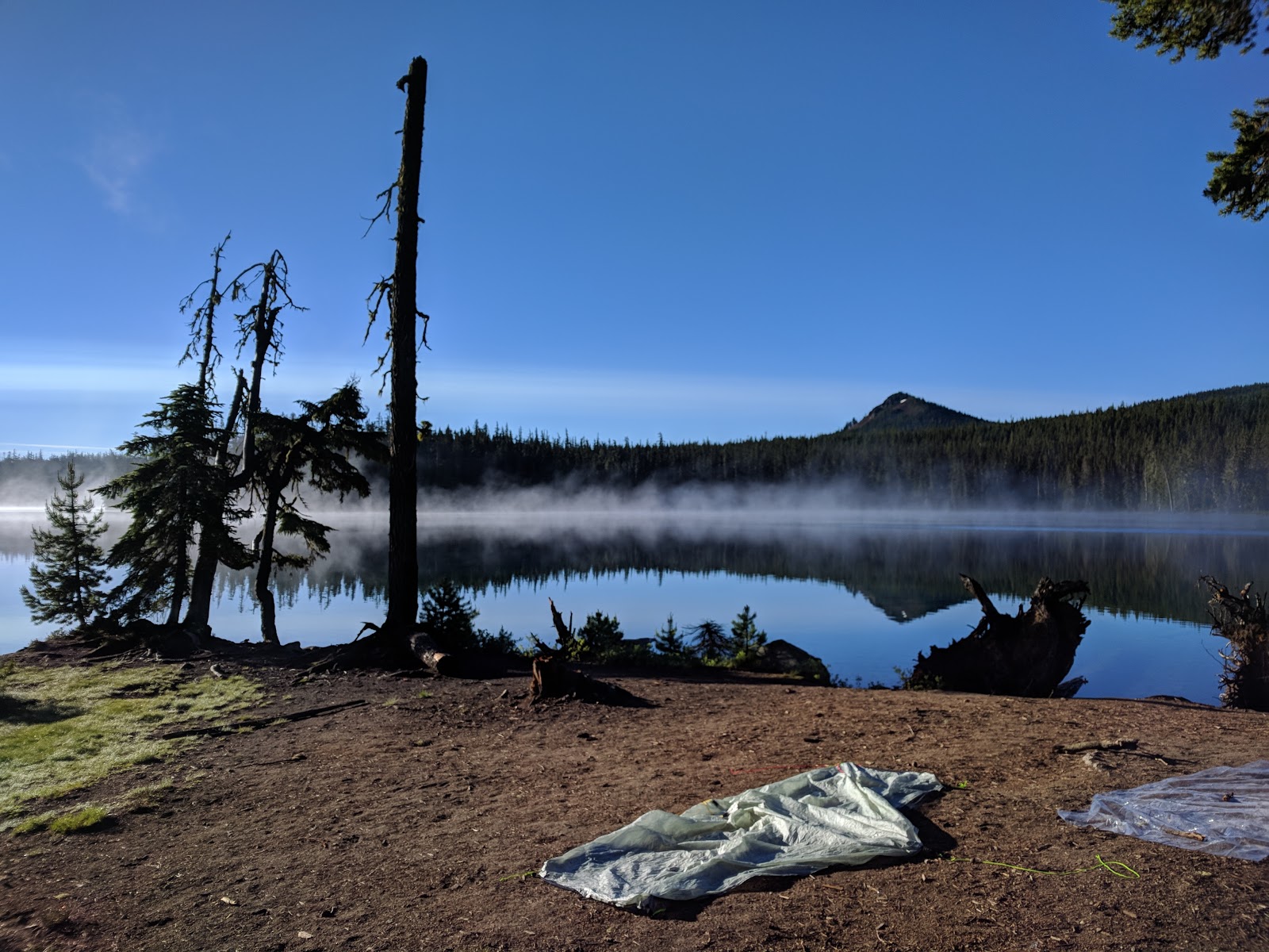
Camp, night 6.

Journal Entry: Tuesday, 7/2/2019

Day 5 of 10

Stats

16.0 miles
1,670' elevation gain
6.0 hours hiking

Photos

Link to all photos and videos from day 5.

Journal Entry

italics = original journal text
regular = added during transcription

Maroon Bells leap of faith (reminder to watch this YouTube video). [insane climbing footage]

Back on trail after a wonderful zero day. After getting into camp around 9:15[pm on Sunday], Kylie and I caught up as I wound down from the high of my day. We spent the next day mostly in our tent taking refuge from the constant mosquitoes and sporadic rain - a surprisingly enjoyable time. 

This morning, we set out for Ollalie Meadow Trailhead, the start of my next segment. Another goodbye and I was off. The trail is definitely more populated now that we are north of the last snow-affected section in Oregon (Mt. Jefferson) - I saw a total of 11 hikers, all of which are either thru hiking (via jumping around to snow free areas) or doing sections of Oregon like me. Eight of us are camped in the vicinity of Warm Springs River.


Trying my best to organize my resupply, unpack, swap packs, and re-pack all in the back of Kylie's Crosstrek. The mosquitoes were too bad to be outside.


Hiking with Baba (Czech for Grandma) and Payday, thru hikers I leapfrogged with for the next 6 days to Cascade Locks.


Debuting my DIY pack! Spoiler alert: It lasted the remaining 100 miles just fine :)


More trees please.

Sunday, July 14, 2019

Journal Entry: Sunday, 6/30/2019

Day 4 of 11

Stats

26.2 miles
3,112' elevation gain
11.5 hours hiking

Photos

Link to all photos and videos from day 4.

Journal Entry

italics = original journal text
regular = added during transcription

What an exciting and event-filled day yet again! Once again, Lauren, Jerry, and I departed for another segment of snow travel - 10 miles today. Having traversed 8 miles thru unknown territory yesterday, I felt confident we would succeed.

We learned that snow is much better to walk on in the morning (less slushy, more solid). We learned that Obsidian Spring has the most amazing rocks and, more importantly, the most amazing water. We learned that politics in Australia is not that different than it is here. And we learned that we were all grateful for having each others’ company the previous 24 hours.

After 22 miles together, I felt (somewhat) embarrassingly bonded to them. But having completed their loop around Three Sisters (an impressive feat considering the conditions), they parted way and I decided I would try to push all the way to Big Lake and arrive at camp tonight instead of tomorrow morning. Borrowing half a liter of water before they left, I made and scarfed 2 packs of ramen for dinner and set off.

Doing the math: I had only done 12.5 miles yet it was already 4:00pm - being on the west side of the Cascade Crest, I figured I had until 9:00pm until sundown - that left 14.5 miles in 5 hours. It was faster than I normally hike but I knew it was feasible if I took very (very) few breaks - just keep moving. If I wasn't going to make it, there were two potential places to camp - one 4.0 miles and the other 2.0 miles from Big Lake.

What I hadn't planned on: 4 miles of lava fields and two 800' climbs. I took them in stride, letting my excitement at having surpassed the crux of the hike (Three Sisters snow adventure) take over. I danced (aka fist pumps on repeat) and sang my way down the trail to Boston (thanks for the recent reminder, Dad). Aside from 5 day-hikers in the few miles near Highway 242, I saw no one for 3 hours and 9 miles - I felt as if I had Mt. Washington Wilderness all to myself! 

To see if I could keep pace thru the lava fields and climbs, I checked my watch hourly. I allowed myself a smidge of leeway for being slow on the first half - the second was all downhill and all on dirt trail. As expected, I was a little behind the 3.0 MPH goal after the first 2 hours. Feeling beat down from the lava trail and first climb, I set my timer for 5 minutes and stopped to stretch. My ankles were quite unhappy with the marble-to-softball-sized rocks of which the trail tread was composed but otherwise I felt fine. My ramen bomb was wearing off already, so as I continued walking I refueled with a Milky Way and Clif Block gummies (the ones with caffeine!). 

The following 10 miles were delightfully uneventful - that is to say expectedly moderately challenging with some nice views of Mt. Washington. Indeed, I successfully made it to camp at 9:15pm right as the sun finished its beautiful set, surprising Kylie and Sheriff both.

Snow for 1/2 mile sections at a time.


OMG snuh.

A steep traverse where I was happy to have micro-spikes and an ice axe.

Resting in the sun. Photo credit: Lauren.

R to L: Seekseekqua (10,497'), Three Fingered Jack (7,844'), Mt. Washington (7,677', my destination for the night).

Mt. Washington getting closer.

Beargrass!

I made it! One day early makes 92 miles in 4 days.

Journal Entry: Saturday, 6/29/2019

Day 3 of 11

Stats

22.8 miles
3,447' elevation gain
9.00 hours hiking

Photos

Link to all photos and videos from day 3.

Journal Entry

italics = original journal text
regular = added during transcription

What a day! After an uneventful first 10 miles, lots of events happened.


  1. I got service at my second break and called Kylie. 
  2. I got caught in a thunderstorm. Luckily it only lasted an hour or so  I took refuge under a small grove of trees. I hadn't seen any lightning to accompany the loud thunderclaps overhead, but didn't want the first strike to be on my umbrella. So I donned my rainjacket and made some ramen while waiting it out. 
  3. I hiked across Wickiup Plain - such a weird and amazing place. Having just hiked out of the previously mentioned thunderstorm, it felt otherworldly to be hiking across a barren, sunny tundra at the foot of South Sister and siblings. 
  4. I met and hiked with Lauren and Jerry who are finishing their Three Sisters circumambulation tomorrow. We linked up right before the snow began in earnest and it was just the mental safety net I needed to push into the evening. The weather and snow conditions were an unknown, while usually-reliable campsites may be under snow. Regardless, the three of us set off at 2:30 with the goal of pushing halfway thru the 18-mile affected area.
  5. We hiked over 8 miles of snow! And we have 10 more miles tomorrow. Luckily, Geoff and I hiked the latter 8 of them last weekend, giving me valuable insight into the conditions.


Camp, morning 3.

Early morning meadow.

Approaching South Sister (left). Broken Top and Mt. Bachelor (right) also passing by.


Waiting out an afternoon thunderstorm. Listen for the thunderclap at the end!

Wickiup Plain - what a cool place to see.


We met a 4-dog sled team out for a Summer trip!


A few miles into the snow.

Camp, night 3.

Wednesday, July 10, 2019

Journal Entry: Friday, 6/28/2019

Day 2 of 11

Stats

22.0 miles
2,013' elevation gain
8.50 hours hiking

Photos

Link to all photos and videos from day 2.

Journal Entry

italics = original journal text
regular = added during transcription

Lots of mosquitos today! Not as bad as 2016 yet though. Backpacker Radio had a listener question about pooping before vs. after digging the cat hole which I was just thinking about this morning while digging mine! (before pooping, FYI).

Also listened to a This American Life episode about a wimp in a football player body. Reminded me of Daro. "Gary Gullman is getting huge!"

Jeff and I leapfrogged with a couple doing the OR section today. They walked quite fast but took long breaks, so we saw them 4 or 5 times. After hiking together off and on for about 20 miles since yesterday afternoon, Jeff and I split up at one of our breaks today. Here, the mosquitoes were swarming him while leaving me in relative peace so he hiked on without me. He and the couple stayed ahead of me for the rest of the day until this evening when I came upon the 3 of them camped at Mac Lake. It was only 4:00 so I filled a bottle and then ate dinner in my tarp. (yes, I set it up just for dinner - the bugs!!!) I continued on for 5 miles until 6:30 so unless I get a late start and Jeff an early one, we likely won't cross paths again.

In addition to the OR section couple, I met Crash and Princess Polly who are thru hiking this summer. 


Camp, morning 2.

A sample of the trash picked up at camp.

Hiking with Jeff.


Update from the afternoon of day 1.

Journal Entry: Thursday, 6/27/2019

Day 1 of 11

Stats

20.3 miles
3,370' elevation gain
7.25 hours hiking

Photos

Link to all photos and videos from day 1.

Journal Entry

italics = original journal text
regular = added during transcription

Saying goodbye was easier this time, but not easy. The weather held up most of the day despite us getting rained on all night at Shelter Cove. My flimsy umbrella held up to 4 or 5 deployments today. The rain was light, but it's already been worth having it. 

The day went by quite fast considering the mileage. I started hiking at 8:00 and was eating dinner in camp by 4:30. After leapfrogging throughout the day, another hiker and I arrived at  and set up camp together. [J]eff is a high school math teacher from Eugene who is hiking from Willamette Pass to Hwy 20 (almost the same route as my first of 3 stints). He is planning on 7 days compared to my 5, but I have a feeling we'll be seeing each other.

A heavy rain started in earnest around 6:00, right as [J]eff was retiring to his tent for bed. I quickly gathered my things and followed suit. Another 20 miles are on the docket tomorrow -- I have to make up time to allow for a slower day or two thru There Sisters so I may try for more if I'm feeling well.


 Happy to be back on the PCT.


I LOL'd.


An unexpectedly cool trash pickup.


Camp, night 1.

Tuesday, September 11, 2018

8/15 to 8/18/2018 - Twin Lakes (Sequoia National Park)


Walk away quietly in any direction and taste the freedom of the mountaineer. Camp out among the grass and [flora] of glacier meadows, in craggy garden nooks full of Nature's darlings. Climb the mountains and get their good tidings. Nature's peace will flow into you as sunshine flows into trees.

- John Muir 


Opening shot - looking east toward the Great Western Divide (just beyond the horizon: Pacific Crest Trail/John Muir Trail, Mt. Whitney, et al). Click this LINK, then right click the image and select "open image in new tab" or "save image as" for full resolution panorama with labels.

Hike Stats

Depart 08:30 on Wednesday, Aug 15, 2018
Arrive 11:45 on Saturday, Aug 18, 2018
(4 days, 3 nights)

27.9 miles
6,173' elevation gain
11 hours, 17 minutes hiking
39 hours, 15 minutes total

Photos

LINK to all photos and videos (many)

Report

Kylie and I arrived at our car-camping site around 5:00pm, set up our shelter, and then snacked while sipping screw-top wine until hiker-midnight (approx 8:30 on this night). Our 2 campground neighbors were as follows: a mixed crowd of 7 backpackers, junior and weathered alike, with which we'd leapfrog on trail 3 times over the next 3 days; the other an endearingly boisterous band of 8+ car-camping buddies whose shenanigans included a rousing game of Mafia which Kylie and I found especially entertaining.

But it was the night before our 4-day hike, so we were grateful that all was quiet once the sun set on Big Meadow Campground. 

Sleep came, then we heard big animal steps - slow and kind of far away but towards the boys' camp. Then... scream-mooing? It was loud and continued off and on for a few minutes and we thought it might be the boys messing with each other - but we also heard large footsteps... Then we heard footsteps by our tarp followed by a loud, "MoooOOOooo."

They were cows. Two of them from who-knows-where, but they just wander around terrifying people for fun I guess.

Oh well. The next morning (Wednesday), Kylie and I were packed up and moving out earlier than either of our camp neighbors. By 8:00am we were driving the short way down the road to Big Meadow Trailhead. 


Falkor (our trusty new Subaru) and our full packs - each with 4 days of food and 1 liter of water.
Now on foot and moving at just 2.5 MPH, Kylie and I immediately observed the differences in Sierra Nevada vs. Oregon hiking. The trees were fewer in number but larger in diameter and more red in the trunk. Where bushes, brambles, and saplings dominate the lush, green understory in Oregon, here at 8,000+ feet, it is sparse of vegetation and mostly sandy.

For Kylie, hiking in the Sierra represented a homecoming - a tribute to her younger days spent backpacking in these same forests with her family. Indeed, the very next day would bring us to Silliman Pass over which her Father and Uncle passed years before on one of their own backcountry adventures. 


Jennie Lakes Wilderness boundary: a literal act of Congress.
Our first 7 miles hiking was nearly all uphill, taking us up the slopes of Shell Mountain, along the perimeter of Poison Meadow, and then finally up the aptly-named Poop Out Pass before reaching the junction for Jennie Lake. Here, we found a picturesque lakeside oasis where we'd loosen our shoes and take a lunch break along the scenic shore.

In two days time, headed back for the trailhead, we'd arrive here again looking for a place to camp. Today, however, required another 5.5 miles of effort to take us all the way to Twin Lakes.


Not so smelly yet.
Feeling recharged, our shoes were again donned and put to work. A short jaunt brought us to the boundary of Sequoia National Park. Though I imagine many-a-hiker pass by these humble signs with little adoration or notice, I always feel compelled to stop and revel in the importance they portend: that is, a Congressionally-protected wilderness experience. I feel that John Muir and others of his persuasion would be proud enough.

From here we faced a 4-mile, 1,000' descent-then-climb to reach Twin Lakes at 9,419'.


Thanks, America.
At 6:00pm we lumbered into camp, covering 12+ miles and 3,600' gain for the day. After much pacing and deliberation, we set up our tarp and bug-net in a somewhat secluded, though still proximate, flat spot sheltered by a large boulder. There were 15+ people camped within 100' of us and perhaps 30 more dispersed around the rest of the lake but all were hidden from sight behind our large boulder and downed tree. Here we would stay for 2 nights, affording us a base camp from which we could explore the surrounding area carrying minimal gear.


Check out the backcountry toilet! It was great except for the bees.
The next day (Thursday), we slept in before beginning our day-hike up to Silliman Pass around 11:00am. At 10,170' along the Kings-Kaweah Divide, the pass and nearby Twin Peaks (10,479') provide sweeping, unobstructed views of the vast Sierra Nevada.

Most geographically notable of all the sights is the Great Western Divide to the east. Besides housing numerous 13,000' peaks, it separates three major Central California watersheds (Kaweah, Kern, and Kings rivers) and serves as a western boundary of the hallowed High Sierra. Just beyond lie the Pacific Crest and John Muir trails in addition to the tallest mountain in the contiguous US.

Click this LINK, then right click the image and select "open image in new tab" or "save image as" for full resolution panorama with labels.


Kings Canyon in background, cool hat in foreground.

Mt. Silliman (11,188') to the south, across Silliman Pass from Twin Peaks.
Even with ample time to appreciate the views at the top, we were back in camp by 3:00pm. Dinner was once again enjoyed lakeside. 


Alpenglow sunset over (big) Twin Lake.

Camp, nights 1 and 2.
The morning of day 3 (Friday) marked the beginning of our return journey. Luckily, our itinerary included spending 2 days to tackle the 12 miles back to the car - we were accordingly pleased with ourselves for having handled that distance on our first day.

Goodbye, Twin Lakes.
The day of hiking was hot, a direct result of our casual 11:00am start. No matter, there were only 6 miles to span on this day. 


Searching for shade.


A huge natural drainage along the trail; I would love to see it flowing in the Spring.
At 2:00pm we approached Jennie Lake for the second time and already there were a handful of groups set up around the lake. One such cohort, a father with 2 kids, was camped much too close to the shores of "The Peninsula" despite the clearly-posted rules and signs prohibiting it.


No camping on the "The Peninsula"...

...unless you reallllly want to.
For shame! Nevertheless and again after much pacing and deliberation, Kylie and I enjoyed our spacious and legal campsite upon a small rise well outside the 100' restoration area. More groups trickled in throughout the evening; after all, it was Friday.

As the sun fell, Kylie suggested that we forgo the tarp and instead set up only the bug-net, trusting that the weather would continue to provide. We were appropriately rewarded as countless stars above served as our gentle night-light, urging us to stay awake. We reluctantly resigned to sleep on this, our last night in the wilderness.

Camp, night 3.
The next morning, our last cups of hot chocolate were relished as we packed up for the last time. We were on trail by 8:00am with our sights set on showers and snacks. This 4th and final day of our trip held only 7 downhill miles between us and Falkor. From there, we'd drive to the family cabin in nearby Kings Canyon National Park.

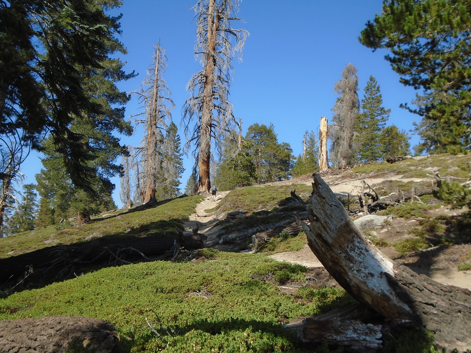
The remaining section of trail now felt familiar, having traversed it just 3 mornings prior. We hiked swiftly but stopped freely to enjoy the small details: a pine cone with brilliant pink insides, a huge snag overhanging the trail.

The scale is immeasurable.
Now a weekend day, we passed many groups who were headed out with varying levels of preparedness; Kylie and I were happy to be on the other end of our trip. 


Hooray!