Wednesday, July 4, 2018

6/29 to 7/1/2018 - Salmon-Huckleberry Wilderness Loop


Counter-clockwise loop.

Stats

Depart 17:30 on Friday, 6/29
Arrive 09:16 on Sunday, 7/1

27.7 miles (plus 3.1 other miles)
7,200' elevation gain
12 hours, 40 minutes hiking
39 hours, 48 minutes total
2.43 hiking mph

1 owl, 3 salamanders, many bees, many birds (heard), 1 tick

Photos

Link to all photos and videos (many many)

Report

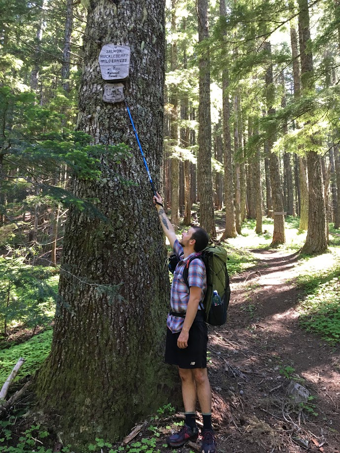
My BFF and I were looking at the Loowit Trail for last weekend, but we weren't sure about the snow conditions or weather. So we went with something much closer and very different: a loop through the Salmon-Huckleberry Wilderness along Eagle Creek and the ridges that connect Tumala Mtn, Sheepshead Rock, and Wildcat Mtn.

We drove out after work and got only slightly lost near The Douglas Trailhead (called Wildcat Mtn Trailhead in Google). The directions given in the Field Guide are correct, I just misinterpreted them. Roads are paved the whole way until the parking lot.

After our brief detour, we arrived at the TH around 17:20 and were pleased to see only 2 other cars.

The ultimate trailhead vehicle.
We came upon one of their humans 1/4 mile in; he was headed back towards the TH. This was the last person we'd see for 39 hours until we were back within 1/4 mile of our car -- true wilderness solitude!

With only 4 hours of daylight, it was convenient that day 1 was all downhill, losing over 2,000' on the way down to Eagle Creek. The trail was great except for when it was overgrown by salmon berries and thorny bushes.

BFF in the bush -- the thorny ones bite.
Along our entire route, we encountered 20-30 patches of overgrown trail, each ranging from 10-100' in length. Perhaps 25% of these patches had thorny bushes, making shorts a questionable choice. My pants-clad hiking partner certainly fared better than I.

We had dinner at a small creek where it crossed the trail and then made camp a mile further down, well uphill and away from the creek. Bug pressure was minimal and the weather was clear and calm so we chose to forgo both our tarp and bug shelter. It was our first time "cowboy" camping and it was truly an amazing experience. As dusk faded, we were able to hear and then see an owl fly quite near us (video of hoots in album). 6.5 miles on the day.

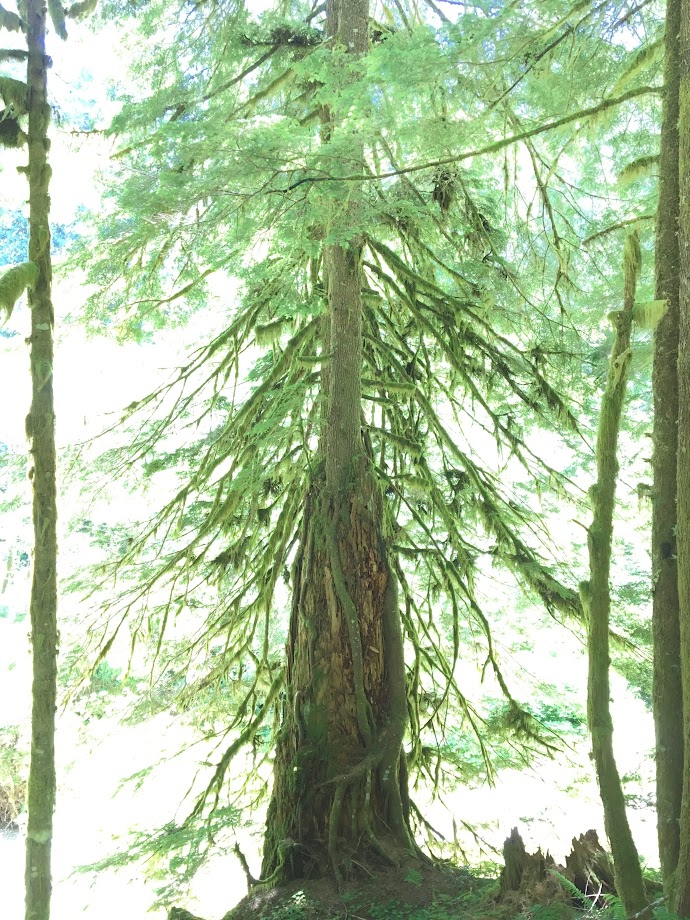
Day 2 required 16+ miles and 5,000' gain. We broke camp and were hiking by 9am, a little late for the long day ahead. The forest here along Eagle Creek holds a fantastic mix of old and new growth. Isolation from civilization was noticeable and the the occasional airplane served as the only reminder of our proximity.

We meandered along, stopping to scope out the established campsites (of which there were 3) and to take videos of each other.
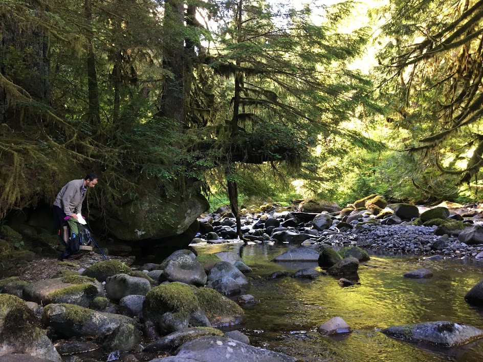

Breakfast spot, day 2.

Old life supports new.


Beautiful.
The Eagle Creek Ford was a mostly dry, easy one. Although steep, the Eagle Creek Cutoff Trail is wide and clear, climbing 2,000' up to gain the pass below Tumala Mtn.

Why so high? At least losers hadn't yet put bullet holes in them.

At 16:30 and mile 11 for the day, we paused for dinner at a tremendous southerly vista -- Tumala meadow and lakes below -- created by an impressive rockfall. Confident of having a water source at camp that night, we consumed all of our water with our dinners.
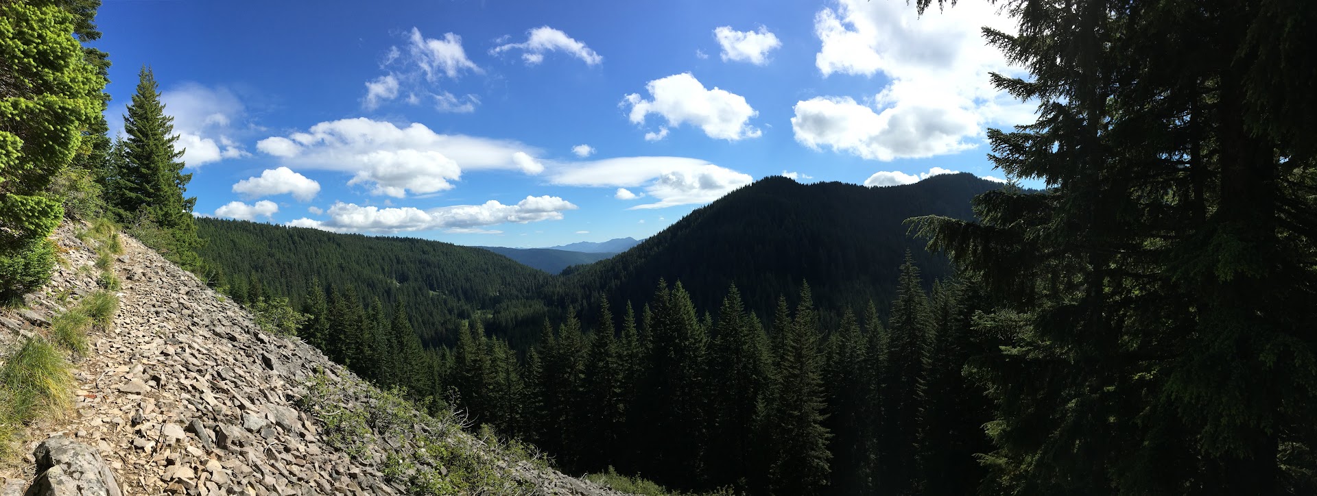
Dinner with a view.

Our relaxing 9am start and leisurely pace along Eagle Creek earlier in the day got us into camp just as the sun was setting, not affording us enough time to search for the proper Coffman Camp and associated spring. So again we turned off trail and found a stealthy flat spot free of bushes under and large tree and canopy. We went to bed thirsty and hungry, afraid to eat any of our candy bars lest it dry out our mouths further.

Having been treated so well by the weather the night before, we decided to only set up the bug shelter and again go tarp-less. We ignorantly dismissed the low, dense fog around us and laid down for the awful night ahead.
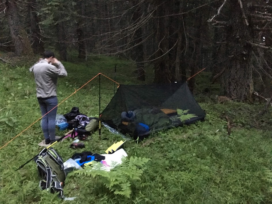
Camp, night 2.

Drops began falling on our faces around 22:00, so I suggested simply pulling the tarp inside our bugnet and laying it over the top of us; we figured the weather would be temporary and therefore lazily chose to forego getting out and properly setting up the shelter above us (we later posited that this "rain" was likely just water condensing out of the fog onto the tree leaves above us and then raining down onto us. i.e. if we would've camped in the open, we likely would've stayed dry[er]).

The clear drawback of this plan became evident as condensation began soaking us from the inside, under the tarp. In addition, puddles began forming around us inside the bug shelter soaking the feet and sides of our bags. Feeling defeated, we quietly settled in for a night of wet tossing and turning with little to no sleep. The lesson we learned was clear: bite the bullet and set up your shelter properly at the first hint of weather. 16.5 miles and a monkey butt load of climbing on the day.

We arose with the sun, thankful to be thru the night. Save for the long undies and fleece shirt I was wearing, everything else was wet: hiking clothes, shoes, backpack, beanie, etc... Packing up was a cold and somber affair.

Luckily, we had only 4.7 miles back to the car on this day, our third and final of what had been a generally enjoyable trip. Coffman Camp and its spring was just 1/2 mile down the trail from whence we camped and so we replenished our bottles and continued on. Our sorrows began melting away once we were covering ground; the weather was mild if not a bit wet and the trail was clear of overgrowth. 

Happy hikers.
By 09:00 we had reached the gravel pit and knew we had made it, our feeling of accomplishment duly earned. 

Thursday, August 18, 2016

Journal Entry: Wednesday, 8/3/2016

Day 15 of 15

Stats

3.6 miles (plus 6.5 other miles to Forest Road 4230)
2,089' elevation gain
4.5 hours hiking
2.24 hiking mph

Photos

Link to all photos from day 15.

Journal Entry

italics = original journal text
regular = added during transcription

There is no journal entry from this day.

After waking up at the semi-established campsite, I noticed that one hiker was already gone while the other duo was packing. I made my hot chocolate, then packed up.

Feeling hopeful that my ankle would be better, I walked the first 100 yards to the nearby creek, where I filtered 2 liters and continued on. While filtering, the older duo that was camped near me passed by, hiking slowly.

Hiking on, I knew within a mile that I needed to quit. My ankle was worse than the previous 2 days and was nearly too painful to walk on, even with my hiking pole for a crutch.  

I scanned my maps, looking for two things: a high point where I could get cell service and an exit point for the trail, preferably leading to a nearby forest road. Luckily, I found both of these at about mile 4 for the day.

After about an hour, I caught one of the hikers that passed me while I was filtering earlier. Her slow pace was a good match for my bad ankle, so we hiked the remaining mile together. She was talkative, which helped take my mind off the pain. Once at the trail junction leading to Forest Road 4220, I said goodbye and let her know my trail name and that I was exiting the trail. 

First, I hiked down this new trail about 1/4 mile to survey its condition. It appeared to merge with an old forest road that matched my maps. I then retraced my steps back to the junction at the PCT.

Now back at a known location, I took a bearing from my maps and, compass in hand, started off-trail up the nearby South Pinhead Butte (5,348'). After a 30-minute excursion through the overgrowth, I stood atop the butte on the trunk of a fallen tree anxiously checking my phones for cell service. Fortunately, I had service on my burner phone and proceeded to call Kylie. I let her know I needed to be picked up and that I would coordinate a pickup with Geoffrey, who has a Jeep that is far more capable on unknown forest roads than Luna.

After a frustrating 30 minutes of losing and gaining cell service, I had coordinated a pickup location with Geoffrey, who gratefully agreed to leave work early to come rescue me. Because I was leaving the trail and going off-itinerary, I gave my current location and proposed meeting location to Kylie in case of emergency.

As I hiked back down the slope towards the trail, I kept my compass out to be sure I was following the correct bearing. After breathing a sigh of relief when I rejoined the PCT, I hiked the short distance back to the trail intersection leading to Forest Road 4220 and began the 5 mile hike out.

The first 3 miles were on an old, unmaintained forest road with a plethora of downed trees. Unlike blowdowns on the well-traveled PCT, these had no existing paths around or over. In addition, the brush lining the road was quite overgrown, meaning my only option was to blaze the trail over each downed tree, fighting through sharp branches. The combination of these obstacles and my injured ankle made for a frustrating and arduous time, but I knew what I had to do.

Eventually, I made it to Forest Road 4220, a dirt road in better shape and continued on towards Forest Road 4230, my pickup point. While hiking these last 3 miles, my mind wandered from reminiscing about my slowly ending hike to wishing for a random car willing to give me a ride. The Advil was wearing off and I was stopping every 5 minutes to rest my ankle, which was getting worse.

Having planned this rescue mission using only Google Maps, I was still uncertain that Geoffrey would be able to reach our pickup point. Some roads that appear fine online can sometimes be unpassable, either by downed trees or locked gates. The worst case would be that he was both unable to reach me and unable to contact to me (neither of us had service). In this case, my only option would be to begin hiking along his proposed route until I met him at his road block. The mere thought of this was sickening, as another X miles seemed impossible at this point. 

2 hours after I left the PCT, I arrived at the intersection with Forest Road 4230. I then realized that I was a couple miles closer on Geoffrey's route than our coordinated pickup point. Instead of suffering through 2 more pointless miles, I sat on the side of the road to wait. I readied my emergency whistle to signal him when he arrived.

After only 10 minutes, I heard the first car of the day and knew it was him. Because he wasn't expecting me for another 2 miles and I was sitting off to the side of the road, he drove right past me as I frantically blew my whistle and waved my arms. I panicked, realizing that if he missed me I would have to hike the remaining miles to our pickup point.

Luckily, he located where the whistle was coming from right as I was going out of view. I breathed a third sigh of relief that day and loaded into his Jeep.

The drive home was pleasant. Our conversation kept my mind off the gravity of the situation; that I was driving away from the trail, away from my goal, and towards the real world at a tremendous speed.

I felt helpless and pathetic in some ways, but empowered in others. I showed myself that I was capable of safely and efficiently coordinating my rescue from the wilderness; that I was capable of making the decision to stop hiking; that I gave it everything I had. Still, leaving the trail at my emotional high-point with only 4 days left was one of the hardest decisions I've had to make.


Forest Road 4220.

Snacking, whistle at the ready. Paved road seen in background.

My rescue team.

Tuesday, August 16, 2016

Journal Entry: Tuesday, 8/2/2016

Day 14 of 15

Stats

20.4 miles (plus 0.5 other miles from Jefferson Park campsite)
2,360' elevation gain
8.0 hours hiking
2.61 hiking mph

Photos

Link to all photos from day 14.

Journal Entry

italics = original journal text
regular = added during transcription

Woke up to the coldest morning yet. Jeff Park was amazing in the morning as expected.

On my way out, I stopped for water at Russell Lake. The low temperature slowed my filter excruciatingly, making my freezing fingers all the more uncomfortable. 

Hiked in my puffy (this was the only time I had to wear my puffy jacket while hiking in the morning) to the top of the pass north of the park (2 miles), then noticed the entire valley and mtn were enveloped in a cold fog. The valley where Jefferson Park is located went from clear and sunny to 100' visibility in 30 minutes (see photo sequence below). The cold wind came howling over the pass, bringing the fog with it. This continued down the other side [of the pass] for about an hour. The north side of the pass was erie [sic] & spooky. Visibility only about 100' and large snow patches. Felt like the moon. R achilles was worse than yesterday, so I wrapped it with an Ace bandage and took some Advil. Helped a lot once it kicked in, but I couldn't tell if the wrap did anything. Hoping it feels better tomrw...

This was the second full day having a sore achilles and I began to worry that it wouldn't get better. I started adjusting my hiking style to ease some of the pain, but this stressed other muscles in my legs. Ignoring the pain was difficult, as I could feel it with every step.

Stopped at Ollalie Lk, whose store was disappointing. Hiking in, I was naively dreaming of burgers and hot dogs, so anything less was heartbreaking. They had a decent beer selection, but limited food. I settled on (Hop Valley's) Alphadelic IPA, Cheetos, & an ice cream bar. They didn't have WiFi or even a cc machine, had to ring me up by hand.

Afterwards, I was both sad and relieved at the lack of technology. I believe that if there would've been cell service or WiFi, I would've called Kylie and discussed getting picked up (due to ankle). This may have indeed been the right call to make, but I was still hopeful that my ankle would get better.

I met a few SoBos out front [of the store]. A friendly bunch who even gave me some heel lifter insoles. He said he struggles w/ the same issue and that they helped.

Walking around out front of the store, I felt that these may help. Once back on trail however, they made little-to-no difference to my already-injured ankle.

Saw my first bear around mile 16 today. It just ran across the trail about 50' in front of me.

After the spectacular scenery the day before and the bear sighting today, I began to feel that my hike was coming to an end; that these were offerings from the trail before I was forced off.

Didn't have service all day after descending the pass at mile 2, despite leaving my burner phone on all day. I hope that changes tmrw. It was nice to txt Kylie for the 30 mins I could.

Camped @ a large-ish spot w/ 2 other groups. Everyone was tent-bound by 6.


 Hiking out of Jefferson park (7:08am).

 Fog just starting to roll in (7:38am).

Fog increasing (7:45am). 

At the top of the pass (8:09am).

 Looking north towards where the trail leads.

Trail descending on snow through fog.

 Lunarscape.

Numerous large cairns; evidence that this area gets high snow levels late into the season. 

More unique trail.

Camp, day 14.

Journal Entry: Monday, 8/1/2016

Monday, 8/1/2016: Day 13 of 15

Stats

19.4 miles (plus 1 other miles to Jefferson Park campsite)
4,152' elevation gain
7.75 hours hiking
2.63 hiking mph

Photos

Link to all photos from day 13.

Journal Entry

italics = original journal text
regular = added during transcription

New month, new day.

Hiked in[to] Jefferson Park today after 19 miles & 4,100' elev gain, R achilles sore all day. This was only somewhat unsettling. I've dealt with a sore achilles tendon before, but most times it would get better throughout the hiking day. This time, it was sore from about mile 3 through the end of the day. Was planning on stopping @ Breitenbush CG (5 miles further), but my sore ankle and the setting thought otherwise. And boy am I glad. This huge meadow lies just north of Mt. Jefferson. A few modest-size lakes are near the PCT. I'm staying about 100 yds east of Russell Lake at a lesser used spot among the patches of trees. The view of Jefferson is amazing. Reminds me Mt. Hood up close.

The ranger I spoke to below essentially told me that I could camp wherever I wanted; he and his partner weren't going to be patrolling that area for permits that night. However, I didn't want to set a bad example by displaying to others I was breaking the rules.

I first found a spot right on the lake, but only reserved designated sites are allowed w/in 250'. I took the opportunity to dry my ground cloth, clothes (after a swim), and quilt while basking in the sun. I then packed up and hiked ~1/2 mile to the far side of the lake & a bit beyond. Favorite campsite so far.

Not only was this campsite aligned with the rules, it was more secluded and had better views of the mountain.

Ran into a ranger rt after Russell Creek (not related to lake) who was out searching for a lost teenaged hiker (actually 21 years old). The helicopters and planes have been incessant throughout the day, searching from the summit to Jefferson Park.

I learned from the ranger that Riley Zickel was the missing hiker. He departed on an overnight trip the previous Wednesday (6 days prior) and had not been seen since.

After crossing the raging Russell Crk, this news was a stark reminder of nature's unyielding force. I hope he's alive & found.

Russell creek was the most treacherous crossing I encountered on my trip. While not comparable in danger to early-season crossings in the Sierra Nevada range, it presented a challenge that was not trivial. I spent 30 minutes walking upstream and back, searching for the safest spot to cross. Eventually, I made the crossing near where the trail intersects the creek.

Started Red Rising (audiobook) today & I think I'll like it. Already on Ch. 13(?). The one where Daryl (Daro?) is at the carver.


 Headed towards Mt. Jefferson (10,497').

More unique trail.

More unique trail, this one through a colorful meadow.

Views opening up, Mt. Jefferson getting closer.

Three Fingered Jack (7,841') 10 miles to the south.

 Looking up towards the summit of Mt. Jefferson from Milk creek along the western slopes.

Final switchback before descending to Russell creek.

Red stick figure is my size and is shown for scale.

 First picture from Jefferson Park.

First campsite, just drying everything out.

 Just like being at the laundromat; except way better and nothing like the laundromat.

Having second dinner, Jefferson Park.

#wildernessculture or something. 

Sunset from camp in Jefferson Park.

Monday, August 15, 2016

Journal Entry: Sunday, 7/31/2016

Day 12 of 15

Stats

13.8 miles
2,904' elevation gain
5.0 hours hiking
2.76 hiking mph

Photos

Link to all photos from day 12.

Journal Entry

italics = original journal text
regular = added during transcription

After driving north from Odell Lake through Bend and Sisters, Kylie and I got to Big Lake Youth Camp around noon. Here, I picked up my resupply box for the upcoming stint. We then drove back to the PCT trailhead at Highway 20, just a few miles north.

Once at the trailhead, I sorted through the food, swapping out items I hadn't been enjoying. At about 1:00, I sadly said goodbye to Kylie and watched her drive away for the second time in 3 weeks.

Back on trail this afternoon. Picked up my box from BLYC (skipped stint 4). Happy w/ my decision to skip so far. It was hard enough lvg Kylie again.

The trail was busy at this time of day; Sunday afternoon means a lot of hikers heading back towards the parking lot. The views were refreshing; Mt. Washington, the three Sisters, and Broken Top all to the South. Three Fingered Jack loomed just to the north, its northern slopes my destination for this abbreviated day.

Did almost 14 miles before finding a spot near a lake. Looking forward to seeing how far I can go each day in an effort to maintain (or beat) schedule.

Caught a couple of thru hikers (from San Diego & Vancouver BC). Hiked w/ them for a while before stopping for dinner. Then found them camped when I got to Rockpile Lake.

Zero days were nice, mostly just for the fact of being w/ Kylie. It felt overwhelming at times, and I had a couple breakdowns over minor things (loading the car w/ groceries). I'm not sure camping was the best idea either. Added complications and still relative comfort.

During these zero days, I found myself full of emotions that I couldn't really understand or explain. I told Kylie that my brain felt like molasses. My thoughts seemed to take a while to form; instead of "popping" into my head, they felt as though I was dragging them to the surface.

It took almost a full day to realize that I was having a hard time adjusting to city life. There felt like there was so much to do and so many things to go wrong. It was then that Kylie pointed out how I'd likely become accustomed to the simplicity of life on trail.

Geoff and Hilary were there for a day as well (Fri night to Sunday morn). We all had a good time playing games and imbibing.

Just saw Sprout go by (as I was laying in bed writing). The rest of the group must just be a day or 2 behind (depending on how many zeroes they took in Bend).

I'm torn b/c I keep thinking in terms of finishing, but am worried I'll regret feeling that way. When I'm honest w/ myself tho, I miss Kylie and being at home. I am happy I got back on trail instead of quitting outright. I only hope I don't regret skipping the last (previous) 86 miles.


 PCT trailhead at Hwy 20 (Santiam Pass).

Looking back towards the south. Right to left: Mt. Washington (7,794'), the Three Sisters (10,358', 10,056', 10,085'), and Broken Top (9,175').

 Looking up at Three Fingered Jack (7,841'). Thru hikers ahead.

View west from the western slopes of Three Fingered Jack.

Mt. Jefferson (10,497') 13 miles to the north.

High point along the traverse of Three Fingered Jack: Porcupine pass. Switchbacks seen below.

First sight of the rescue helicopter. I learned about its purpose later in the day.

Looking back at Three Fingered Jack, amazed at the progress a day of hiking can bring. Mt. Washington, the Three Sisters, and Broken Top also visible.

Sunday, August 14, 2016

Journal Entry: 3 Zero Days, 7/28/2016 - 7/30/2016

Thursday to Saturday

After eating breakfast, doing laundry, and grabbing lunch in LaPine (not a metropolis), Kylie and I headed north 30 minutes to Bend. Here, we relaxed on the banks of the Deschutes, tasted some beer, refreshed our cooler ice and groceries for camping, then got Dinner at 10 Barrel's brew pub.

Sufficiently overwhelmed with the hustle and bustle, I drove us the hour south to Odell Lake Resort, where we'd be camping for the next 3 nights. At our site, the view was beautiful and the bugs were light.

On Friday Kylie and I slept in, then drove down to the lodge to check out the restaurant and get more ice. Once back at the campsite, we walked along the shore of Odell Lake, finding a shady, relaxing spot near the water.

Next, we napped in the tent for 3 hours. Dinner at the lodge was quaint; the food was slow but yummy, and our server was a high school boy (who did surprisingly well).

Geoffrey and Hilary arrived later that night. Saturday, we all enjoyed a relaxing day which included a walk along the lake, board games in the lodge, and a delicious dinner of hot dogs and chili cheese fries (both cooked over our campfire).

Excited to be closer to finishing and anxious to get out of the mosquitoes, I made the decision to skip the next section (5 days, 80 miles) from Shelter Cove to Big Lake Youth Camp. The next day, Kylie and I would head north to Hwy 20 where I would begin my final 150 miles to Cascade Locks.

Driving to Bend.

 View up from lying down on the banks of Deschutes River.

 This crew brought their own Trump sign.

Relaxing on the shores of Odell Lake.

 Sunset, Odell Lake.

Dinner at the Odell Lake Resort lodge.

Hilary and Geoffrey.

Sheriff is my co-pilot.